HOME
REGIONS OF ITALY
PLACES IN ITALY
PLAN YOUR TRIP
Italy in Photos
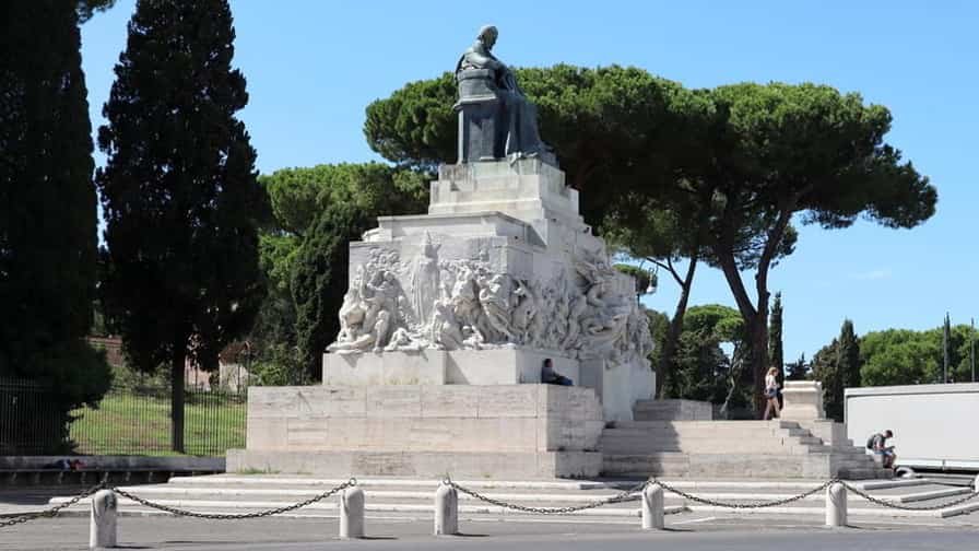
Monumento Nazionale a Vittorio Emanuele II, 00187 Roma, Italy (September 2019)
Rome
Rome, the capital of Italy, is a city where history, culture, and modern life converge in a remarkable and unforgettable way. Known as the Eternal City, Rome has been a centre of civilization for more than two and a half thousand years, shaping the course of Western history, art, religion, and politics. Its influence stretches far beyond the borders of Italy, and its streets, monuments, and piazzas offer a living chronicle of human achievement and creativity. Visiting Rome is not simply a journey to a city; it is an immersion in a layered and vibrant civilization that continues to inspire awe and wonder.
Rome’s history begins in ancient times, with its legendary founding in 753 BC by Romulus and Remus. The city grew from a small settlement on the banks of the Tiber River into the heart of a vast empire that dominated the Mediterranean world. The remnants of this period are still visible today in the city’s archaeological sites, which provide a tangible connection to the past. The Colosseum, perhaps the most iconic of Rome’s ancient monuments, stands as a testament to the architectural and engineering prowess of the Romans. Its massive structure, once the site of gladiatorial contests and public spectacles, continues to draw millions of visitors each year who marvel at its scale and historical significance. Similarly, the Roman Forum and Palatine Hill reveal the political, religious, and social life of the city during the height of the empire, offering insight into the world that shaped Western civilization.
Beyond its ancient heritage, Rome is also a centre of religious and spiritual significance. As the seat of the Vatican City, the independent city-state within Rome, it is the spiritual home of the Roman Catholic Church and the residence of the Pope. St. Peter’s Basilica, with its awe-inspiring dome designed by Michelangelo, dominates the skyline of the Vatican and is one of the most visited religious sites in the world. The basilica’s interior, adorned with sculptures, frescoes, and mosaics, showcases the height of Renaissance art and the devotion of centuries of artisans. Nearby, the Sistine Chapel, also part of the Vatican, houses Michelangelo’s famous ceiling frescoes, which are considered masterpieces of Western art and a defining symbol of human creativity.
Rome’s contributions to art, culture, and architecture extend beyond antiquity and the Renaissance. The city is a living museum, with streets and squares that display Baroque fountains, neoclassical palaces, and modern design alongside medieval churches and renaissance villas. Piazza Navona, with its elegant fountains and vibrant street life, reflects the Baroque era’s exuberance, while the Pantheon, originally built as a Roman temple and now a Christian church, remains a marvel of architectural innovation and proportion. These sites, along with countless galleries, museums, and theatres, demonstrate Rome’s enduring role as a centre of artistic excellence and cultural expression.
The city’s neighbourhoods each have their own character and charm. Trastevere, with its narrow cobblestone streets and lively piazzas, offers a glimpse of traditional Roman life and a wealth of authentic trattorias and cafes. The historic centre, with its iconic monuments and bustling squares, combines tourism and daily life in a way that keeps the city alive and vibrant. In contrast, areas such as Monti and Campo de’ Fiori blend history with contemporary culture, featuring artisanal shops, modern boutiques, and local markets that provide both residents and visitors with unique experiences.
Rome’s culinary traditions are as rich and varied as its history. The city’s cuisine emphasizes simplicity, quality ingredients, and regional specialties. Dishes such as cacio e pepe, carbonara, and amatriciana reflect the flavours of Lazio, the region surrounding Rome, and are celebrated for their balance of taste and texture. Markets, bakeries, and gelaterias offer an array of fresh produce, breads, cheeses, and desserts, allowing visitors to experience Roman culture through food. Dining is often a social and leisurely activity, where meals are enjoyed slowly, accompanied by conversation and the lively atmosphere of the streets and piazzas.
The Tiber River, which runs through the city, provides a natural focal point for exploration and recreation. Bridges such as Ponte Sant’Angelo and Ponte Milvio connect different parts of the city while offering scenic views, and riverside walks allow for moments of reflection away from the bustling streets. The surrounding hills, such as the Aventine and Janiculum, provide elevated perspectives of the city, where visitors can admire sweeping views of rooftops, domes, and the rolling landscape that stretches toward the countryside.
Rome is a city of contrasts, where ancient ruins coexist with modern infrastructure, and quiet neighbourhoods exist alongside bustling tourist areas. Its energy is defined by movement and interaction, as locals and visitors navigate the streets, enjoy open-air cafes, attend performances, or simply admire the beauty of the urban environment. Every corner reveals layers of history, art, and culture, inviting exploration and rewarding curiosity.
In addition to its historical and cultural significance, Rome plays a vital role in contemporary Italian life. It is the political and administrative centre of the country, hosting government institutions, embassies, and international organizations. The city’s economy, education, and media industries contribute to its status as a dynamic urban centre that blends tradition with innovation. Despite its size and complexity, Rome maintains a sense of intimacy through its neighbourhoods, piazzas, and street life, where the everyday rhythms of life unfold alongside the extraordinary monuments of the past.
Rome is more than a destination; it is an experience that engages the senses, intellect, and imagination. Its combination of history, art, religion, and daily life creates a city that is both monumental and personal, inspiring visitors to explore, reflect, and connect with centuries of human achievement. From the grandeur of its ancient ruins to the charm of its narrow streets and vibrant squares, Rome stands as a testament to the enduring power of culture and the timeless appeal of human creativity. For anyone seeking a deep and multifaceted encounter with Italy, Rome offers a journey that is endlessly rich, profoundly moving, and unforgettable.
Worth a Visit
")
Piazza della Repubblica in Rome is one of the city’s most elegant and historic squares, blending ancient heritage with modern charm. Located near Termini Station, it sits on the site of the Baths of Diocletian, the grand Roman thermal complex dating back to the 3rd century AD. The square itself was redesigned in the late 19th century during Italy’s unification, reflecting the city’s transformation into a modern capital. Its centrepiece is the striking Fountain of the Naiads, created by sculptor Mario Rutelli in 1901, featuring graceful bronze nymphs symbolizing natural forces. Surrounding the piazza are sweeping arcades with cafés, shops, and luxury hotels, including the historic Palazzo Naiadi. Nearby, visitors can admire the Basilica of St. Mary of the Angels and the Martyrs, designed by Michelangelo within the ancient baths. Today, Piazza della Repubblica offers a lively mix of history, culture, and everyday Roman life.
")
Foro Traiano, or Trajan’s Forum, is one of the most remarkable monuments of ancient Rome, showcasing the grandeur of Emperor Trajan’s reign. Built between 107 and 113 AD under the guidance of the architect Apollodorus of Damascus, it was the largest and most impressive of the Imperial Forums. The complex included vast colonnaded squares, basilicas, libraries, and the famous Trajan’s Column, which still stands today. The column, decorated with a spiralling frieze, narrates the victories of Trajan in the Dacian Wars and remains a masterpiece of Roman art and storytelling. The forum was a political, commercial, and cultural center, reflecting Rome’s power at its height. Adjacent to the forum is Trajan’s Market, an ancient complex of multi-level halls often considered the world’s first shopping mall. Today, visitors can walk among its ruins and imagine the vibrancy of Rome’s imperial past.
")
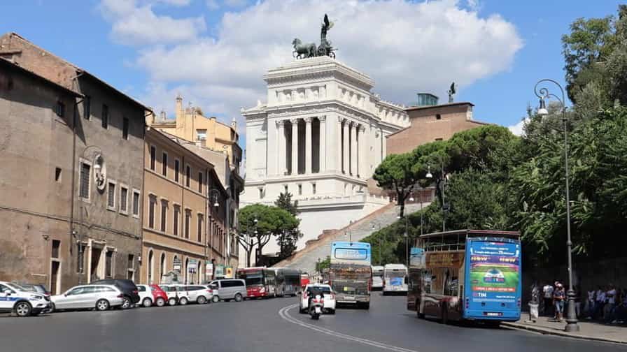
The Monumento Nazionale a Vittorio Emanuele II, also known as the Altare della Patria or “Altar of the Fatherland,” is one of Rome’s most iconic landmarks. Located in Piazza Venezia, it was built between 1885 and 1935 to honour King Victor Emmanuel II, the first monarch of unified Italy. The grand white marble structure, designed by Giuseppe Sacconi, features majestic stairways, sweeping colonnades, and towering statues, symbolizing Italian unity and patriotism. At its centre stands the equestrian statue of Victor Emmanuel II, while the Tomb of the Unknown Soldier, added in 1921, pays tribute to Italy’s fallen soldiers. The monument also houses the Museum of Italian Unification, offering insight into the nation’s history. From its panoramic terraces, visitors enjoy breath-taking views of the Roman Forum, Capitoline Hill, and the city beyond. Both a national symbol and a striking architectural masterpiece, it remains a must-see in Rome.
")
Piazza dell’Arco di Costantino is a historic square in the heart of Rome, dominated by the majestic Arch of Constantine, the largest triumphal arch in the city. Built in 315 AD, it was erected to commemorate Emperor Constantine’s victory over Maxentius at the Battle of the Milvian Bridge. The arch is richly decorated with reliefs and sculptures, many reused from earlier monuments, making it a fascinating blend of Roman art from different eras. The piazza lies between the Colosseum and the Palatine Hill, placing it at the crossroads of some of ancient Rome’s most iconic sites. Over the centuries, the arch became a symbol of imperial triumph and the dawn of Christianity, as Constantine legalized the faith soon after his victory. Today, Piazza dell’Arco di Costantino is a lively meeting point for visitors exploring the Eternal City, offering a striking glimpse into Rome’s glorious past.
")
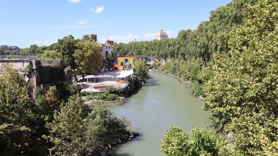
Lungotevere Aventino is a scenic stretch along the Tiber River in Rome, running at the foot of the Aventine Hill, one of the city’s legendary seven hills. This picturesque riverside promenade combines natural beauty with historical charm, offering peaceful views of the water and the bridges that cross it. Strolling here, visitors are surrounded by lush gardens and elegant residences that crown the Aventine above. Just a short walk uphill, landmarks such as the Giardino degli Aranci (Orange Garden), the Basilica of Santa Sabina, and the famous Aventine Keyhole offer some of the most enchanting panoramas of the city. Lungotevere Aventino also provides a quieter atmosphere compared to Rome’s bustling center, making it ideal for leisurely walks or evening sunsets along the river. With its blend of serenity, history, and stunning vistas, it is one of Rome’s most charming and timeless riverside avenues.
Photo Gallery of Walk 1 – Roma Termini, Piazza dei Cinquecento to Via Magnanapoli
Approximately 2.77 km – 1.72 miles
Description of Walk 1
This walk explores the dynamic heart of Rome, blending grand boulevards with historic landmarks. Beginning at Roma Termini in Piazza dei Cinquecento, the route moves along Viale Luigi Einaudi toward the impressive Piazza della Repubblica. Here, the striking Fontana delle Naiadi anchors the space, surrounded by elegant arcades and monumental architecture. Following Via Nazionale, one of Rome’s key thoroughfares, the walk passes a mix of shops, historic buildings, and government offices, reflecting the city’s 19th-century expansion after Italian unification. A detour along Via delle Quattro Fontane leads toward the quieter and refined Quirinale district. The small Giardino di Sant’Andrea al Quirinale offers a brief green escape, contrasting with the urban surroundings. Continuing along Via del Quirinale, the route passes monuments and statues, including tributes to Italian history, before arriving at Piazza del Quirinale, home to the presidential palace with sweeping views over the city. The walk then descends through Via della Consulta and surrounding streets, eventually reconnecting with Via Nazionale. Ending near Via Magnanapoli, the route reveals a layered portrait of Rome, where political power, history, and everyday city life intersect.

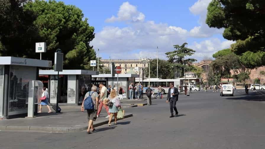
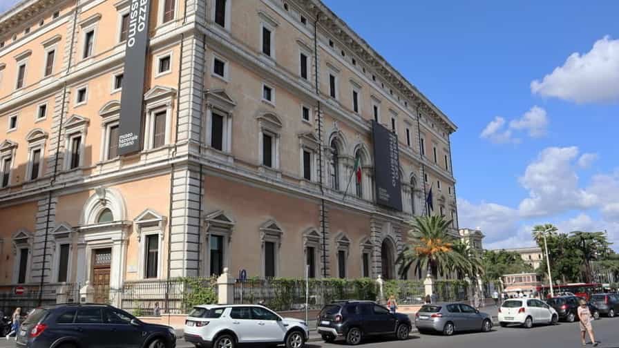
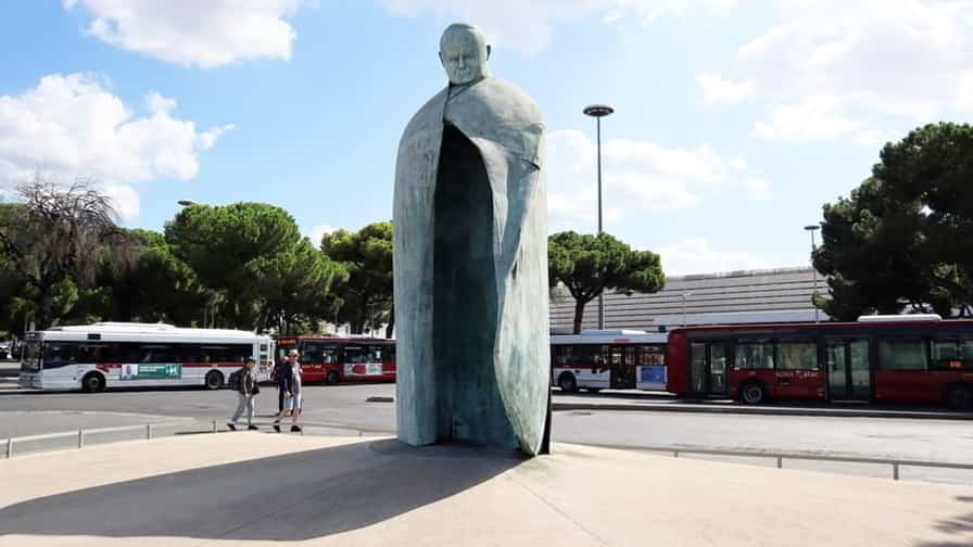
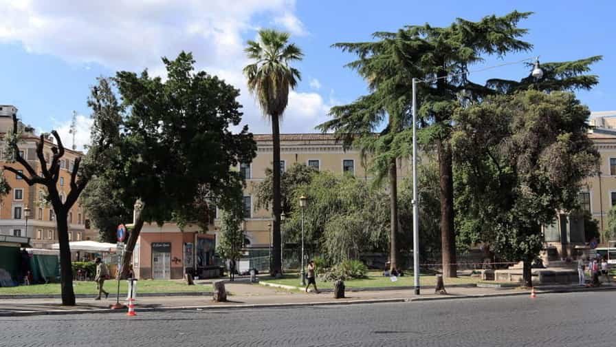
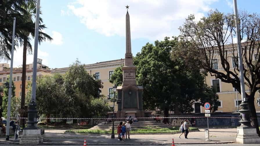
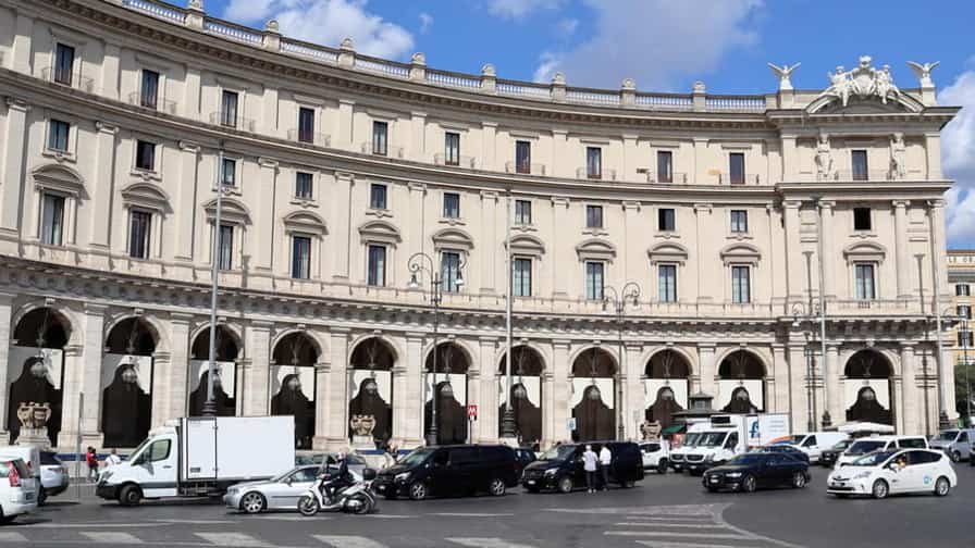

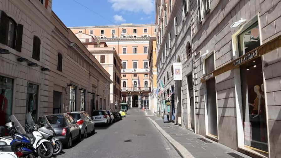
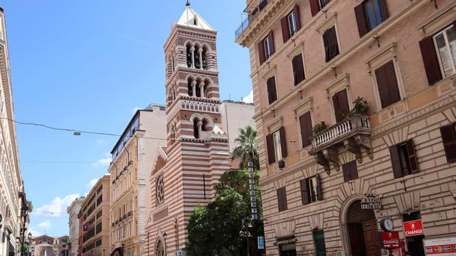
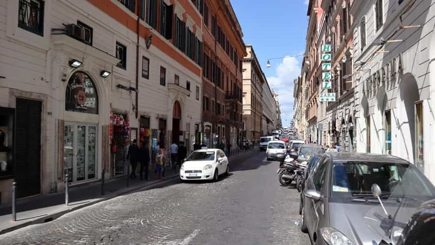
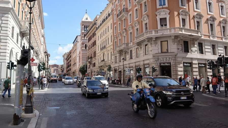
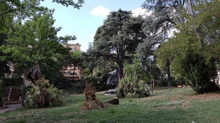
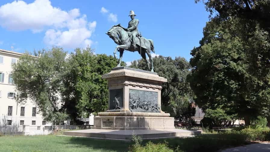
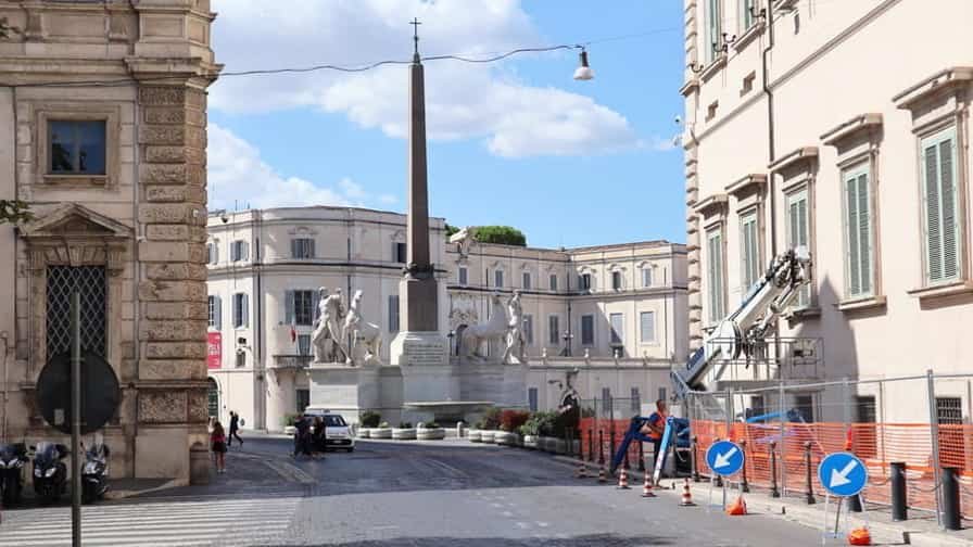
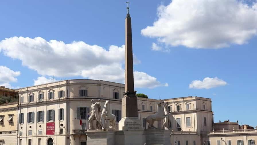
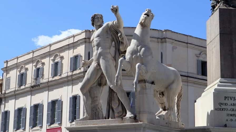
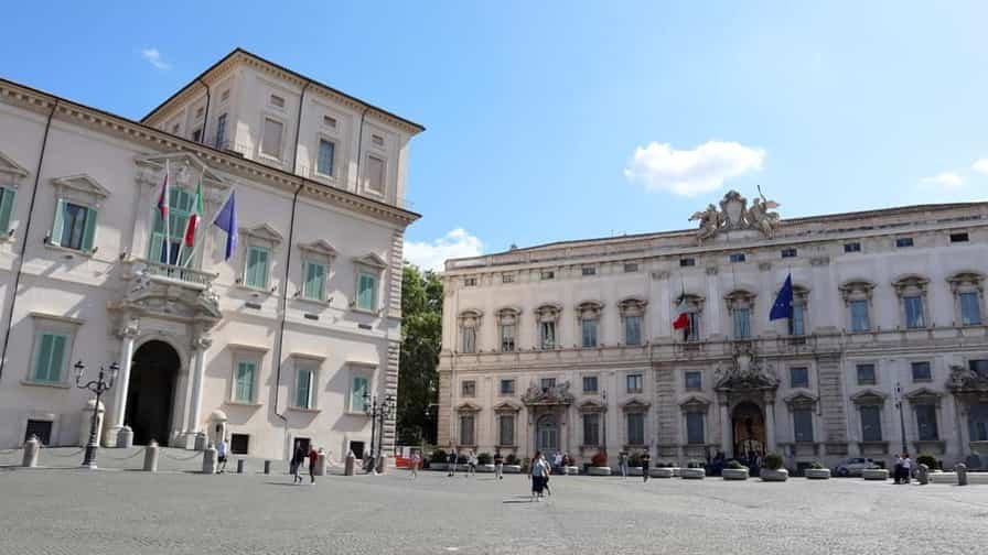
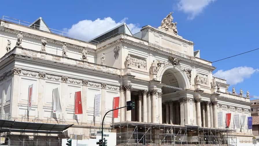
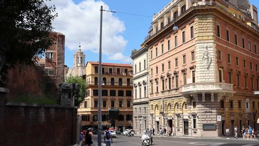
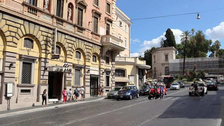
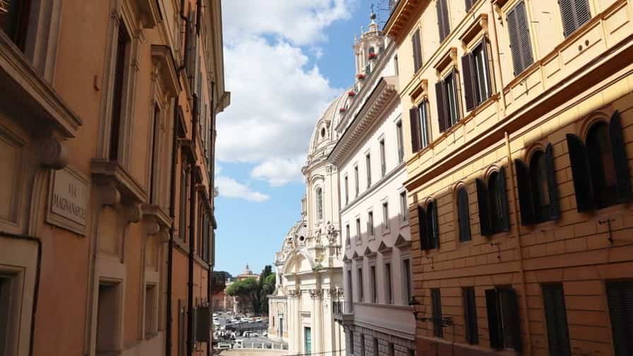

Photo Gallery of Walk 2 – Foro Traiano to Monumento Nazionale a Vittorio Emanuele II
Approximately 0.38 km – 0.24 miles
Description of Walk 2
This short walk takes you through one of the most historically dense areas of Rome, where layers of ancient and modern history meet. Starting at Foro di Traiano, you are surrounded by the remains of one of the grandest imperial forums, once the political and commercial heart of ancient Rome. Following Via dei Fori Imperiali, the route offers sweeping views over the ruins of multiple forums, connecting past grandeur with the present cityscape. The wide avenue, built in the 20th century, contrasts with the ancient structures that line it. Arriving at Piazza della Madonna di Loreto, the space opens toward the monumental centerpiece of the area, the Monumento Nazionale a Vittorio Emanuele II. This striking white marble monument dominates the skyline, symbolizing Italy’s unification. The walk, though brief, captures Rome’s unique ability to blend imperial ruins with national identity.
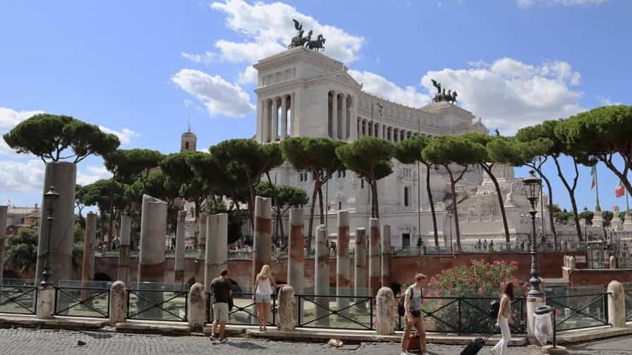
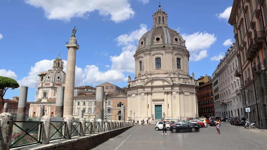
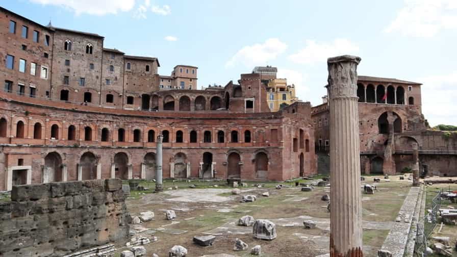
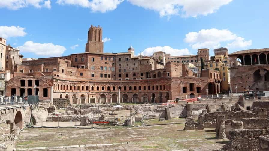
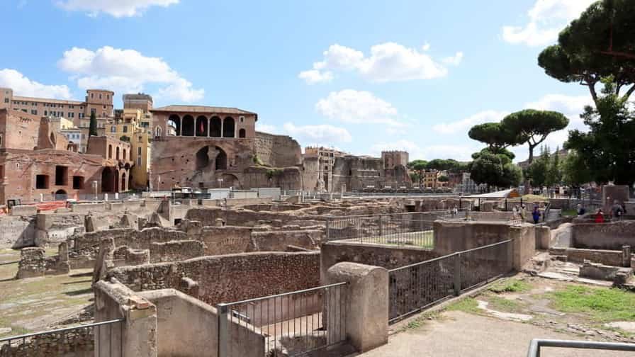

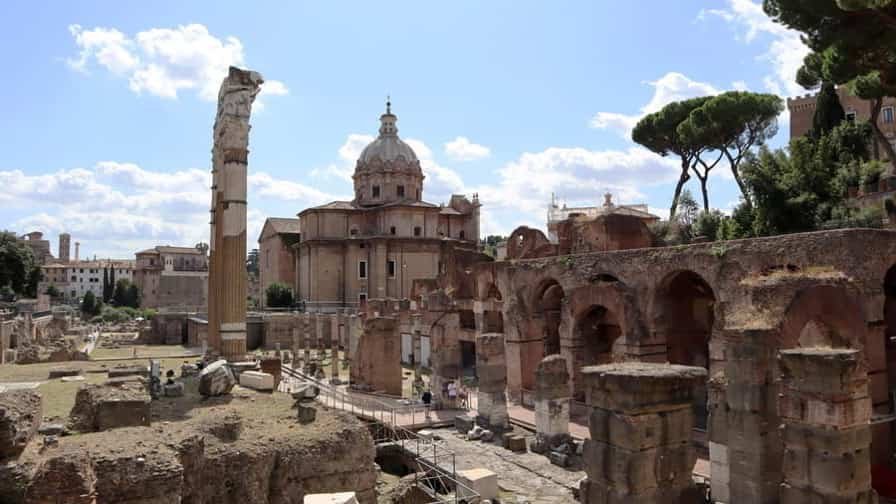
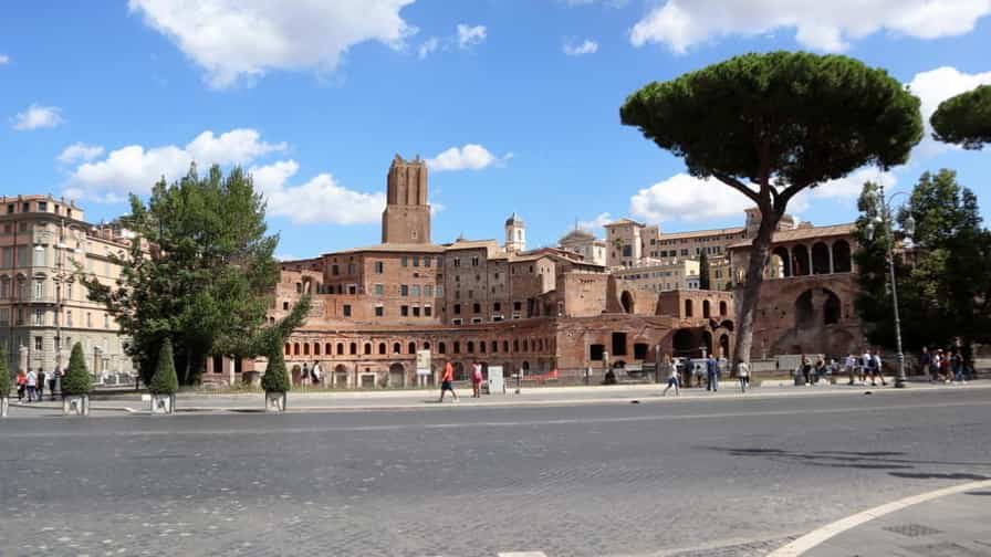

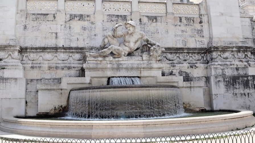
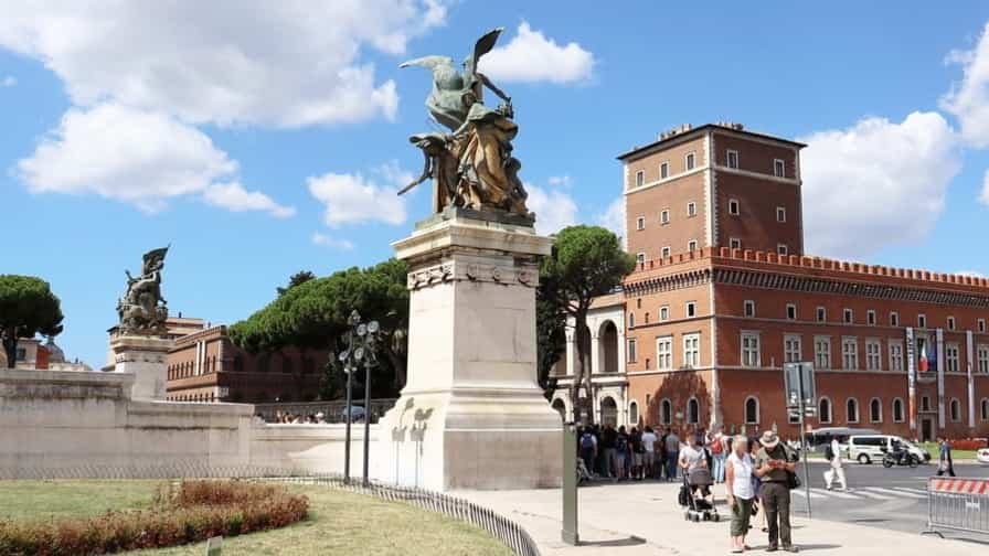
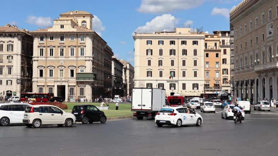
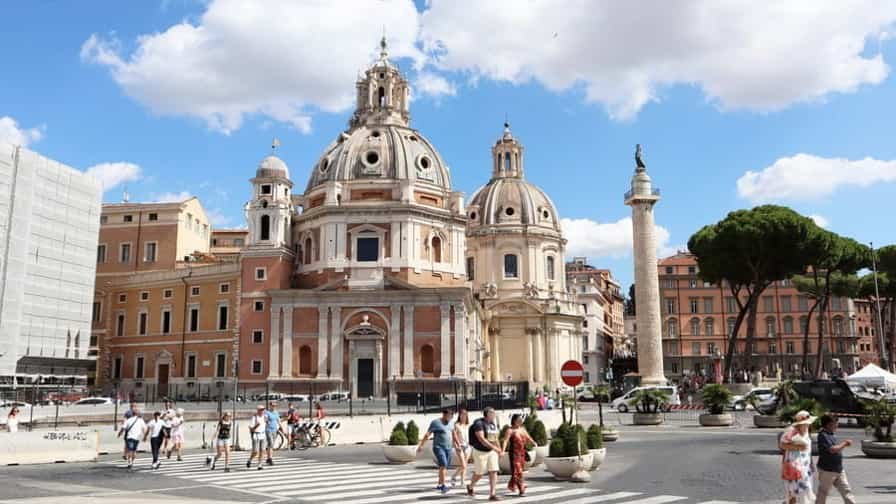
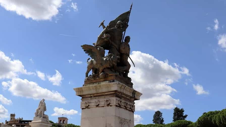
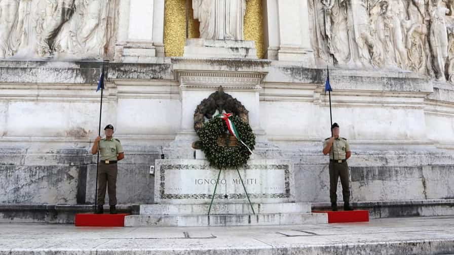
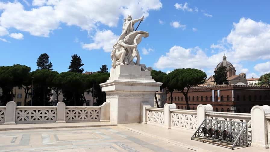
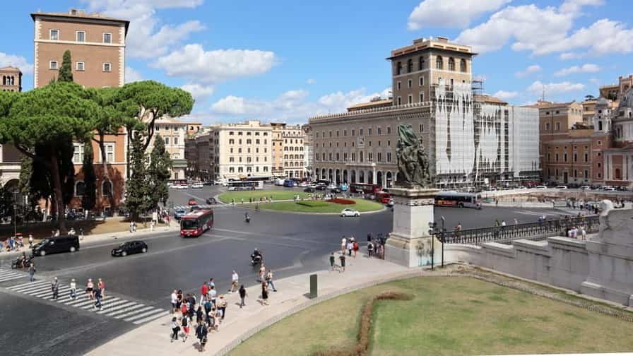
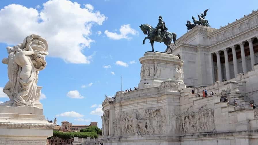
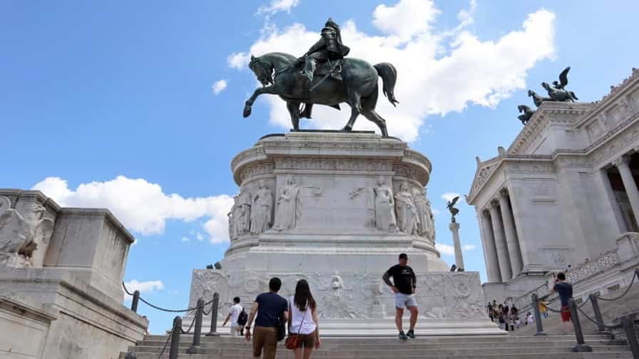
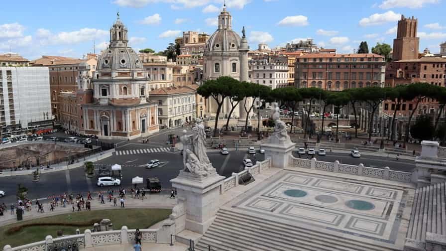
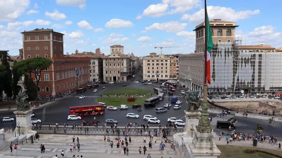
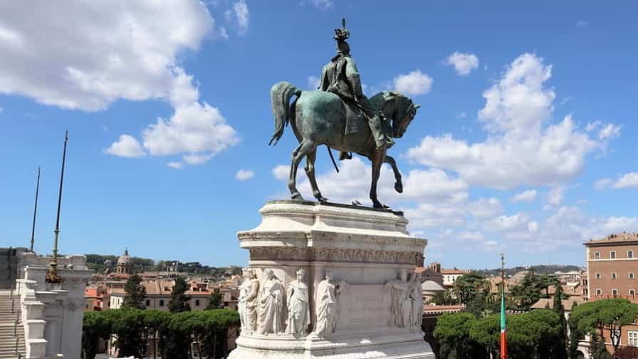
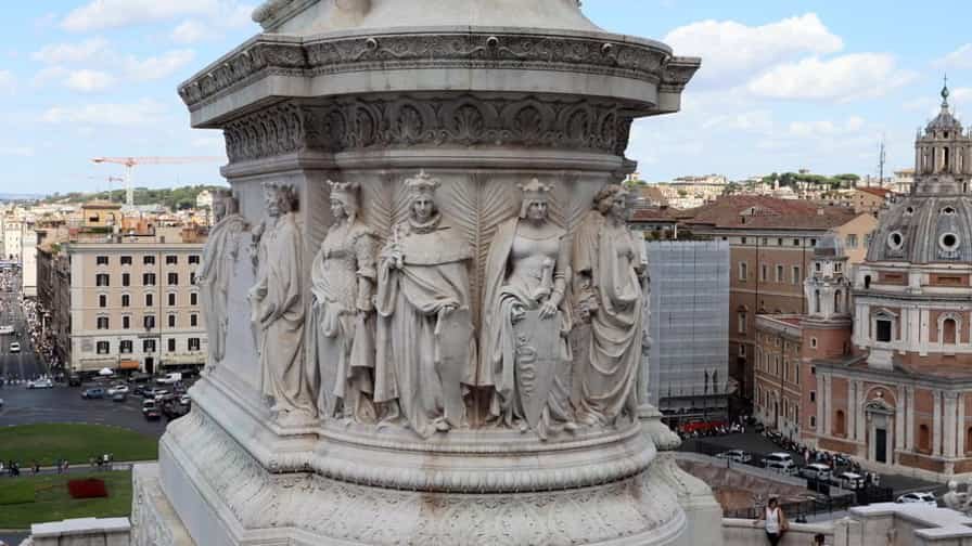
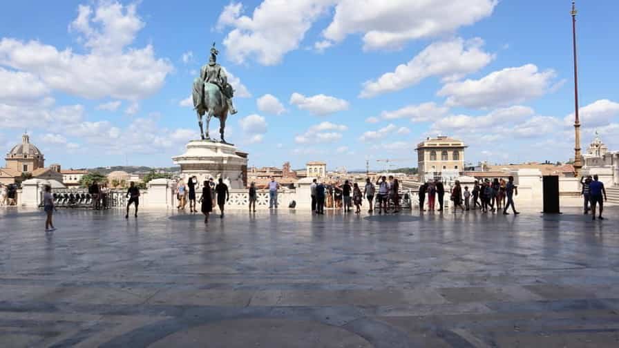
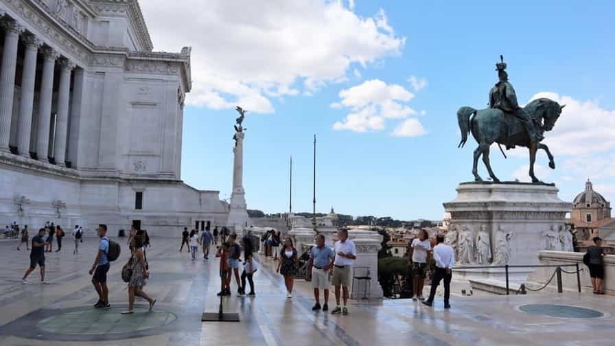
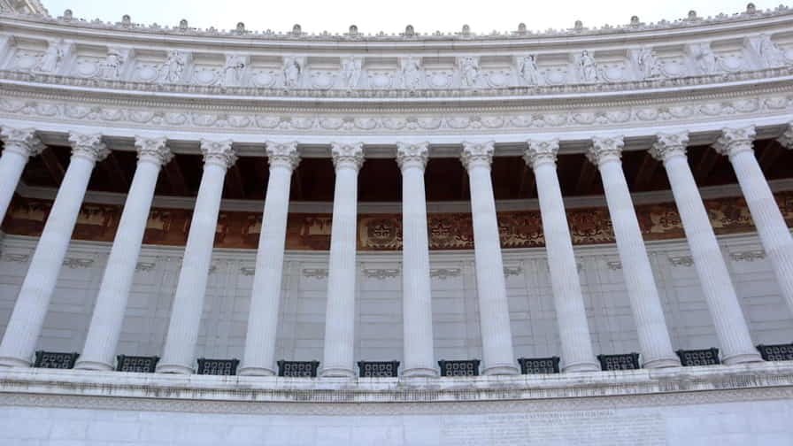
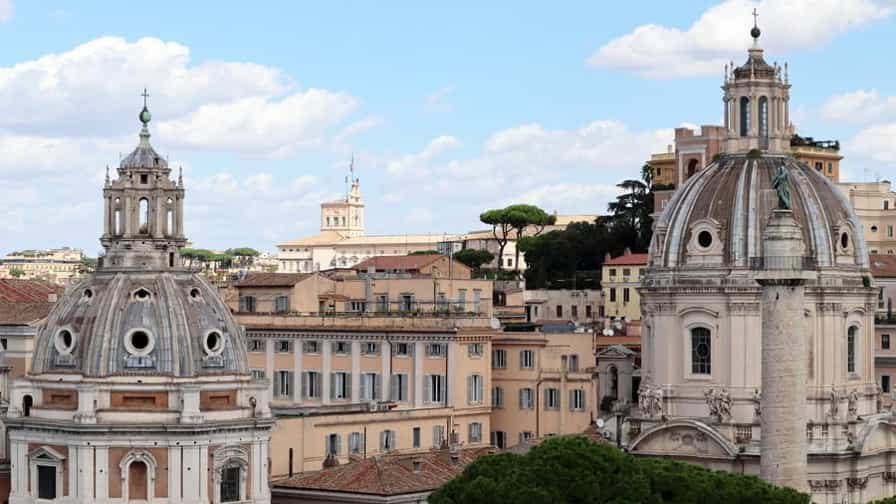
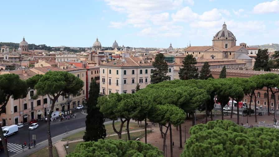
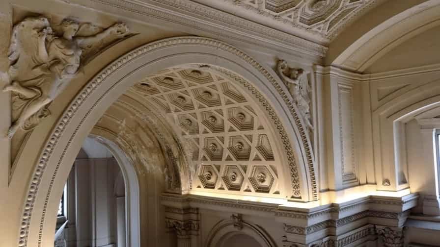
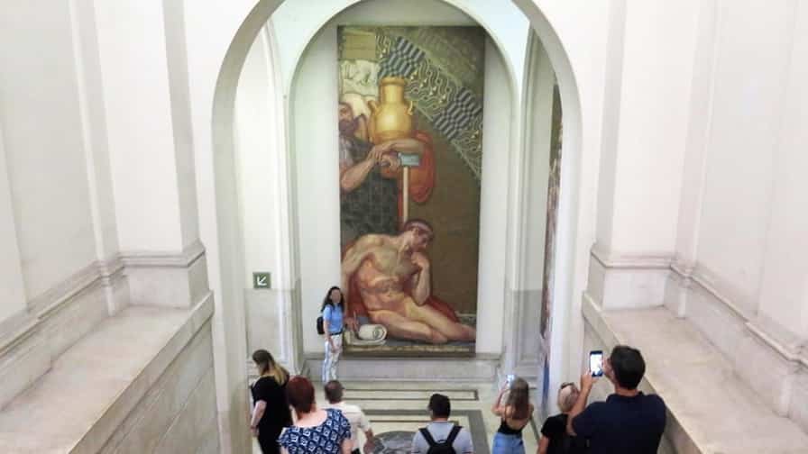
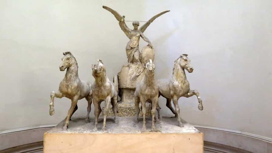
Photo Gallery of Walk 3 – Piazza di S. Marco to Piazza del Arco di Costantino
Approximately 1.33 km – 0.83 miles
Description of Walk 3
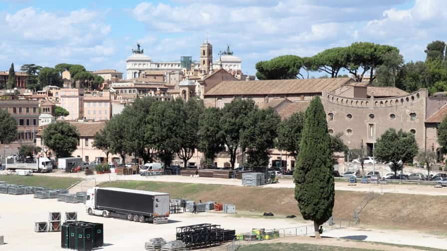
This walk passes through one of the most iconic and historically layered areas of Rome, linking grand squares with ancient monuments. Beginning in Piazza di San Marco, near the Renaissance Palazzo Venezia, the route quickly opens into the vast Piazza Venezia, a bustling hub dominated by traffic and monumental architecture. From here, Via dei Fori Imperiali stretches ahead, offering a dramatic perspective over the ruins of the Roman Empire’s ceremonial and political centres. As you walk along this broad avenue, glimpses of temples, basilicas, and archaeological remains unfold on either side, connecting modern Rome with its ancient past. A brief turn near Largo Corrado Ricci brings you closer to the Colosseum area. Continuing toward Arco di Costantino, the route ends beside one of Rome’s best-preserved triumphal arches, standing proudly near the Colosseum and marking the grandeur of imperial Rome.
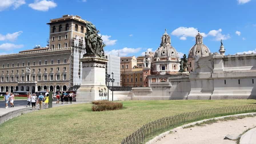
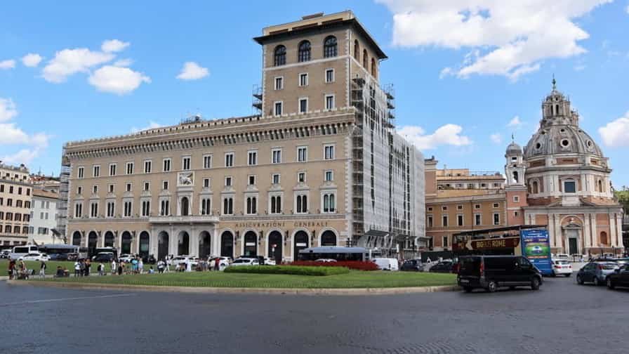
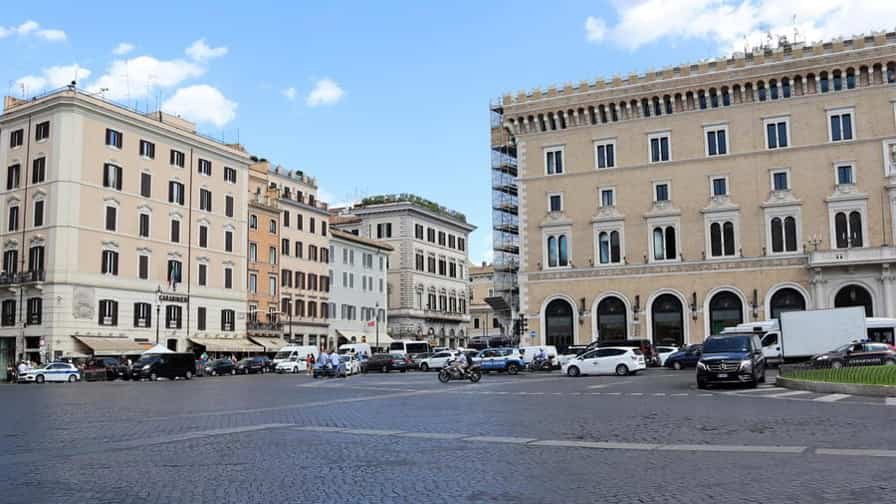
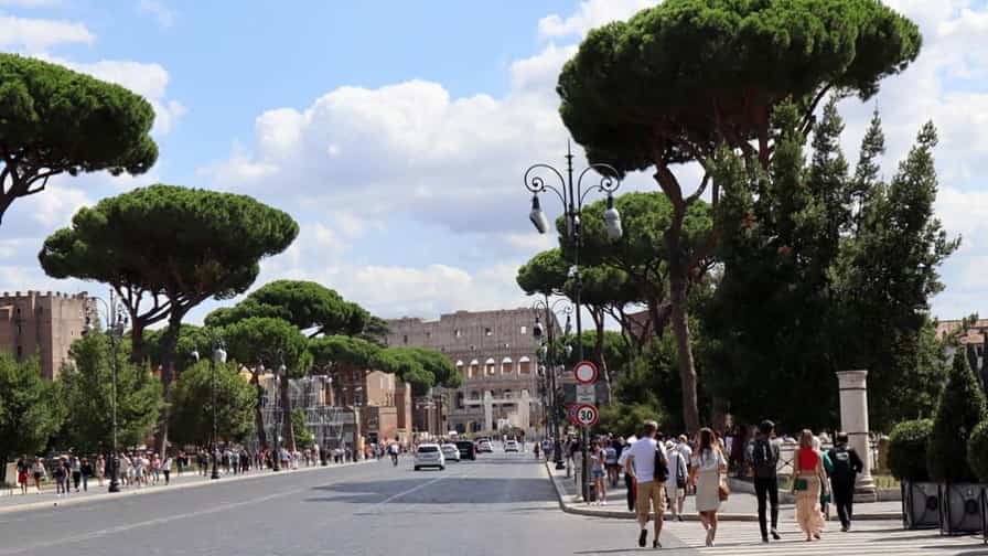
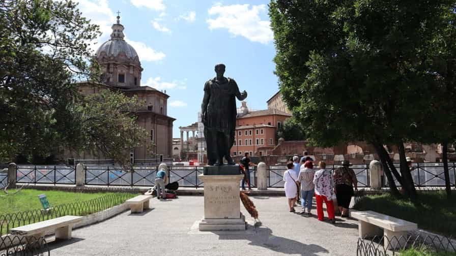

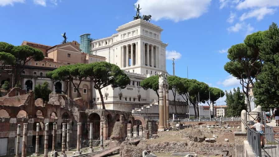


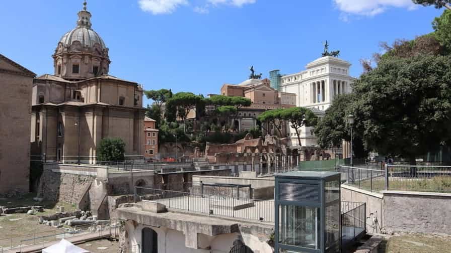


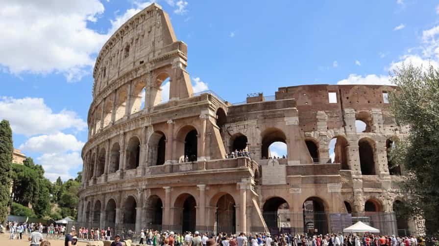
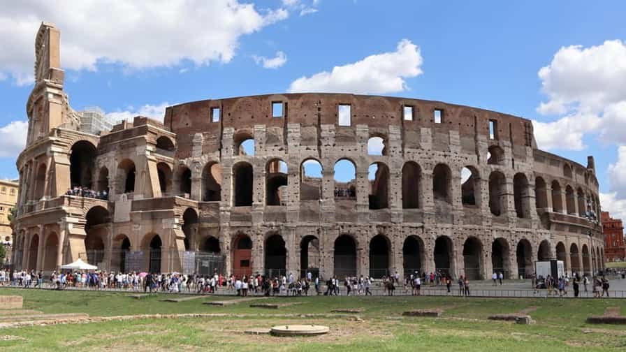
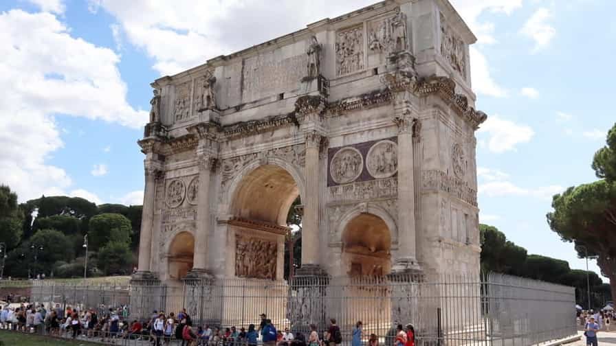
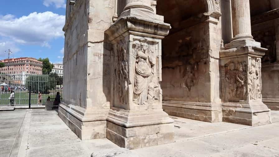
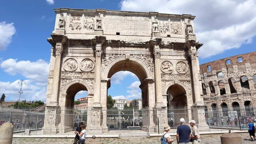
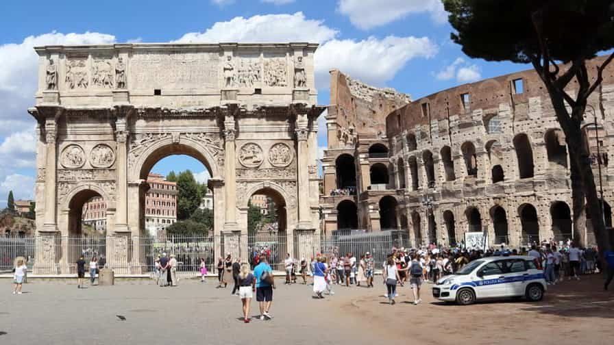
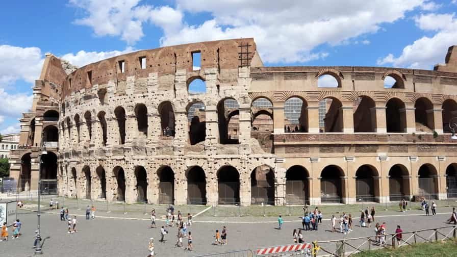
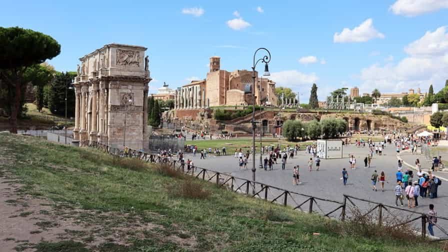
Photo Gallery of Walk 4 – Via Celio Vibenna to Via del Teatro di Marcello
Approximately 2.34 km – 1.45 miles
Description of Walk 4
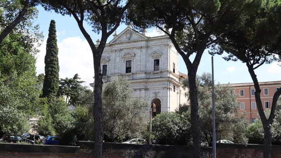
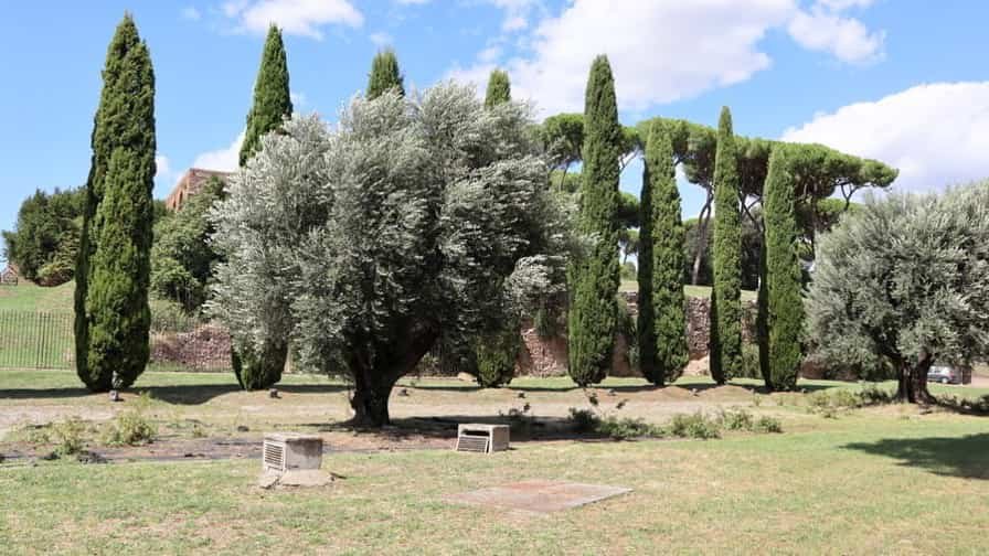
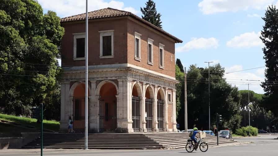
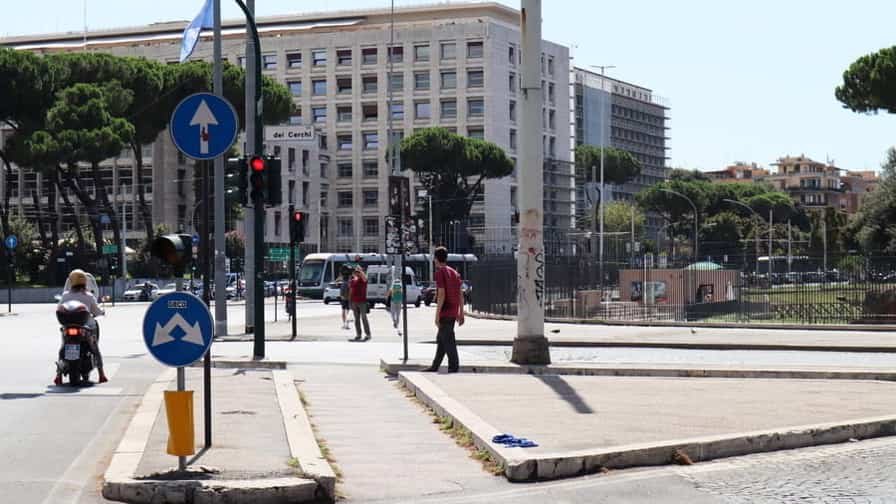
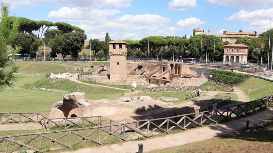
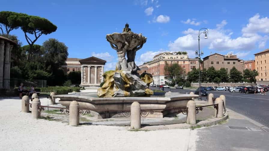
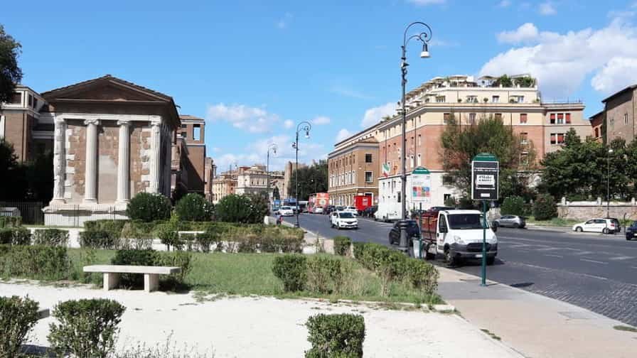
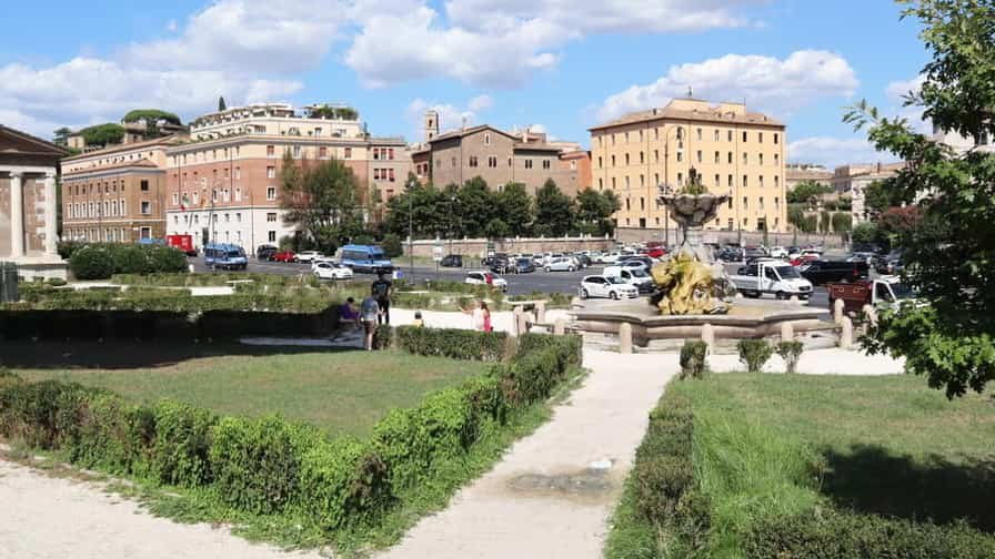
This walk explores a fascinating stretch of Rome, where ancient history and quieter riverside views come together. Starting on Via Celio Vibenna near the Colosseum, the route follows Via di San Gregorio, a scenic road lined with trees and bordered by archaeological remains. As you reach Piazza di Porta Capena, the setting opens toward the valley once crossed by one of the city’s main ancient gates. Continuing along Via del Circo Massimo, the vast space of the Circus Maximus stretches alongside you, evoking the scale of Rome’s public spectacles. At Piazzale Ugo La Malfa, the Monument to Giuseppe Mazzini adds a layer of modern national history. The walk then reaches Piazza Bocca della Verità, famous for its medieval church and legendary marble mask. Moving toward the Tiber, Lungotevere Aventino offers peaceful riverside views before crossing Ponte Palatino. The final stretch along Via del Teatro di Marcello leads past ancient ruins and elegant buildings, concluding near the historic theater, where layers of Roman history remain vividly present.


COPYRIGHT © 2018-2026 ITALY IN PHOTOS - ALL RIGHTS RESERVED